NEW GENERATION HUNTING APP
WHEN
Your trail cam photos hold a hidden story.
We’re data scientists, and we decoded it.
Photos become patterns. Patterns predict your hunt.
He Will Come
TONIGHT
LOCATION
Your Stand
ARRIVAL
5:10 PM
DIRECTION
From SW
OUTDATED APPS
Predicts deer ‘activity’ in your area.
Worthless if you’re in the wrong stand.
VS
DEERMAPPER
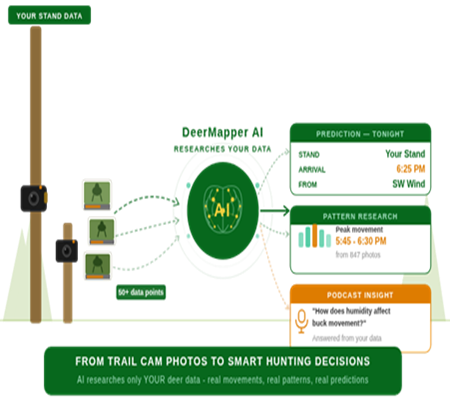
Predicts the exact arrival time at each stand
And exactly which direction the deer will come from.
OUTDATED APPS
AI tags the deer – that’s all.
No location data. No location prediction.
VS
DEERMAPPER
AI Builds a complete intelligence record.
Each sighting is tied to the stand it comes from.
OUTDATED APPS
A scrape map pin without a camera is blind.
No scrape data. Only a guess.
VS
DEERMAPPER
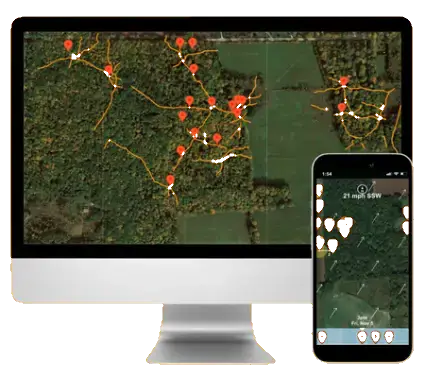
All map pins have location-specific photo data.
The only way for fact based prediction.
OUTDATED APPS
Charts generic weather & moon data.
Do you trust the weatherman?
VS
DEERMAPPER
Empirical Data. Real Deer Movements.
No guesswork. Each stand’s true story.
OUTDATED APPS
Tracks the camera, not the map pin.
Lose the camera, lose the history.
VS
DEERMAPPER
We track the stand — not the camera.
Swap cameras, vendors, anything. The history stays.
We’re giving the first 100 hunters our undivided attention.
Secure your spot to have your land data-mapped by the experts.
WHAT MAKES DEERMAPPER DIFFERENT
“AI research grounded in
your real data,
not generic internet advice.”
Every prediction, every pattern, every insight — built entirely from the deer on your land. Not someone’s weather forecast. Not regional averages. Yours.
Protected by Two U.S. Patents · No. 9,706,756 & No. 12,382,950
STEP BY STEP
We do the work. You Hunt → the Right Stand. Right Time. Every Time.

Other apps guess. DeerMapper AI grows smarter with every photo — unlocking insights.
link to Map
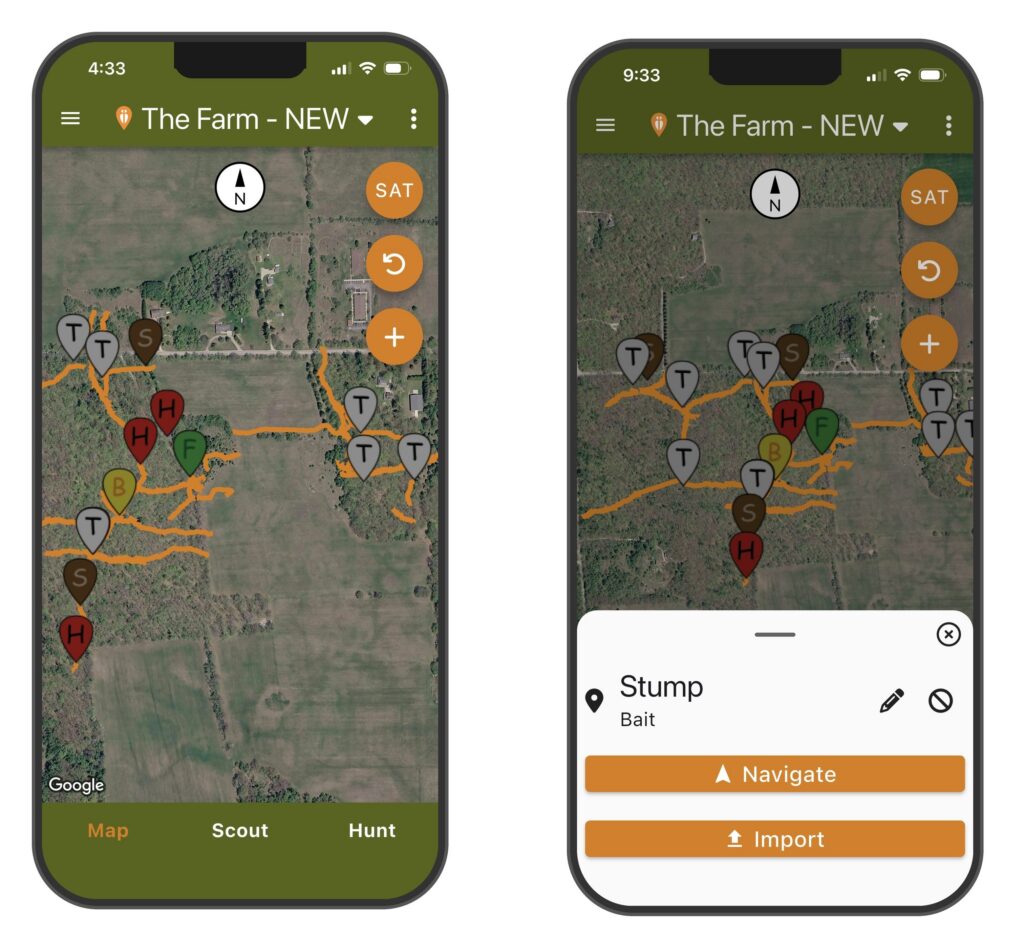
B=Bait, F=Food, H=Hub, S=Scrape, R=Rub, T=Trail, …
Easy to use app with single clicks to get to each function.
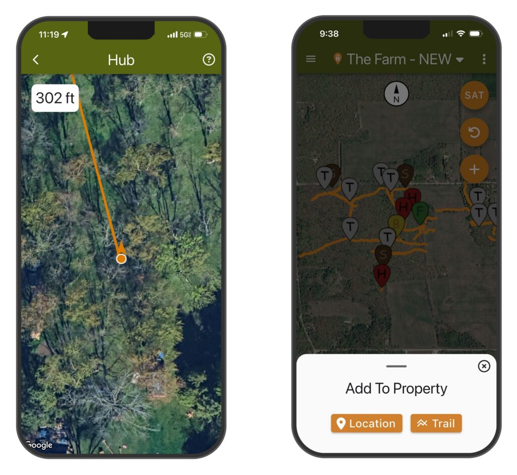
Points your phone providing live guidance directly to any stand. Walks you right to it.
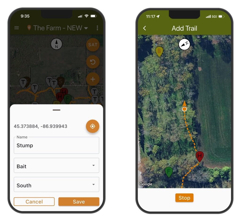
Set the Locations GPS and direction of trail. Walk trails onto the map.
When you are at any Stand just tap once – it captures the precise GPS coordinates.
Walk each trail in real time and DeerMapper records every step.
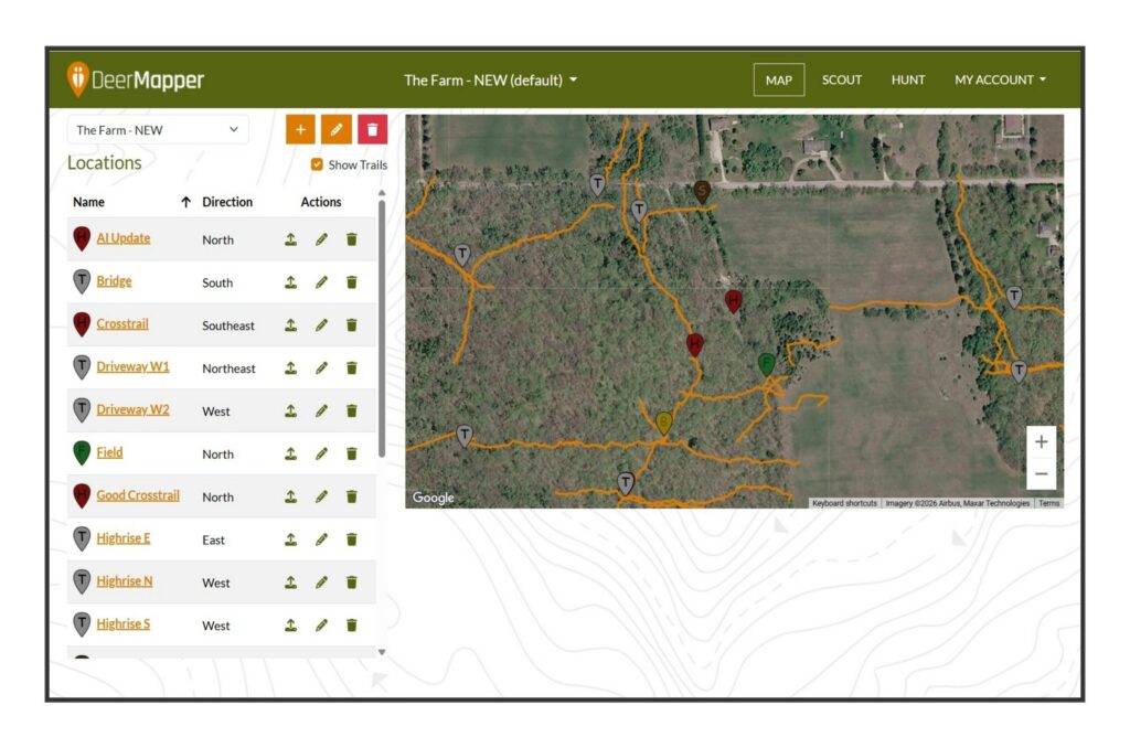
Full property map with every stand listed by name, direction, and type — manage your entire property from your computer.
Drag and drop trail cam photos from any brand. Every photo instantly becomes structured deer data.
link to Map
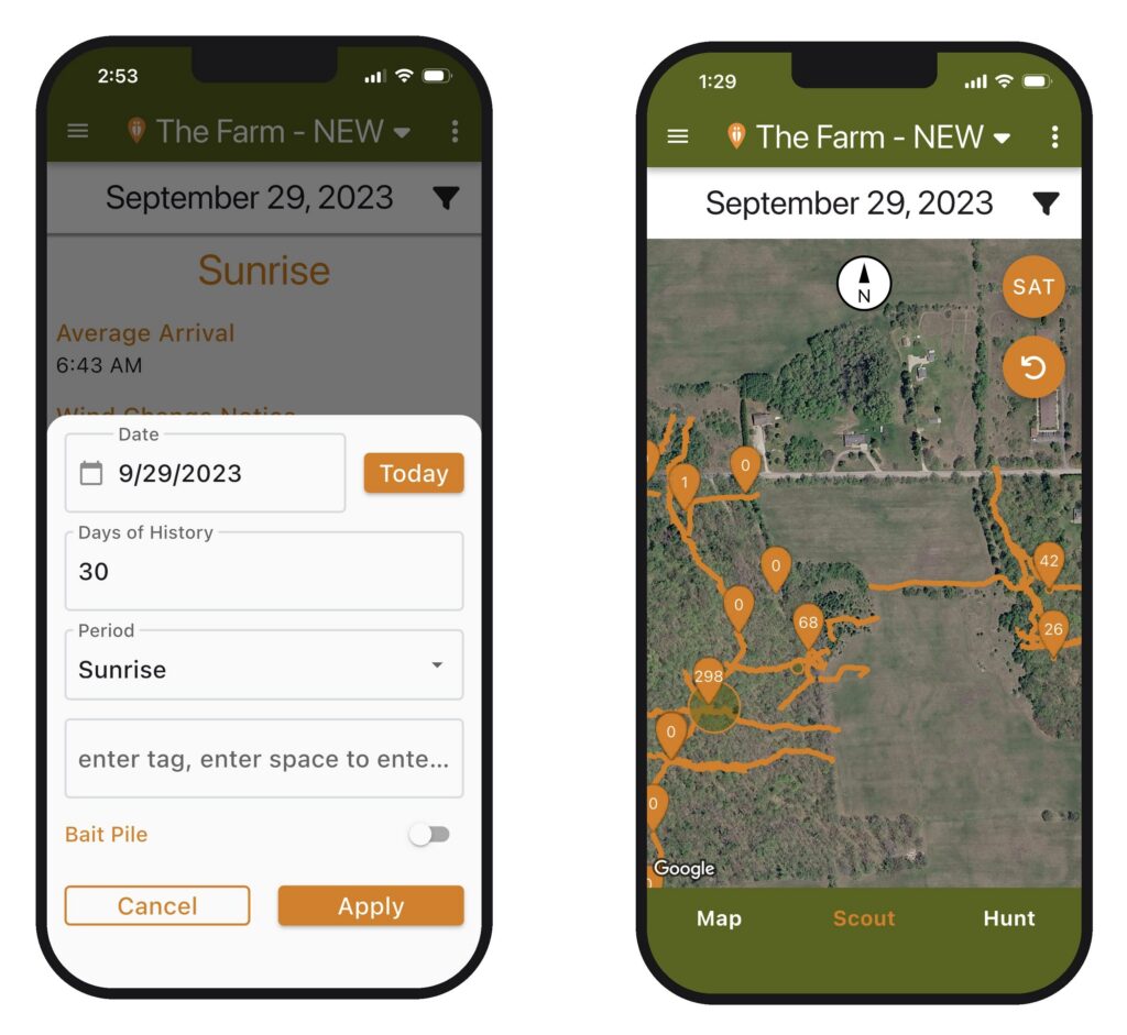
Select the Hunt Date and the number of analysis days by Tag.
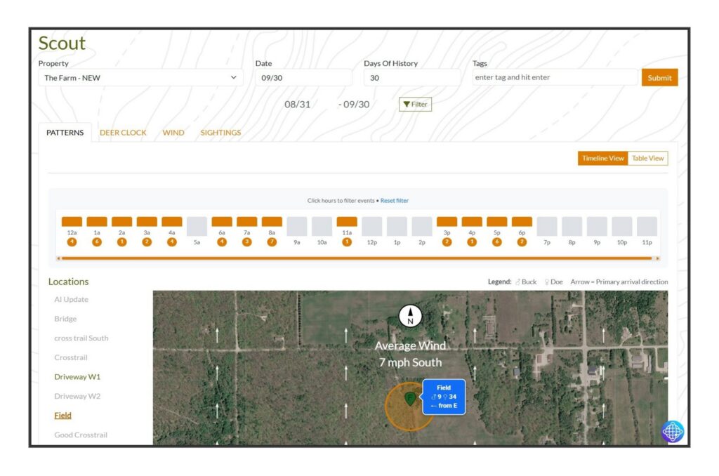
Based on the filter see the number of does and bucks for each stand.
Scroll by hour for movements by wind and travel direction.
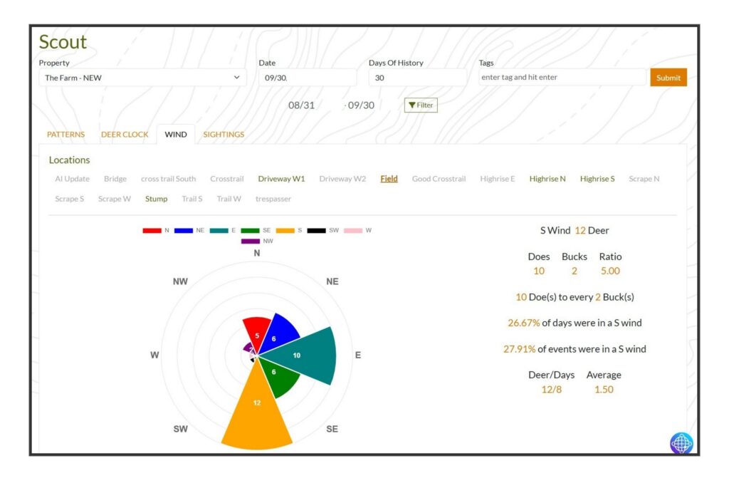
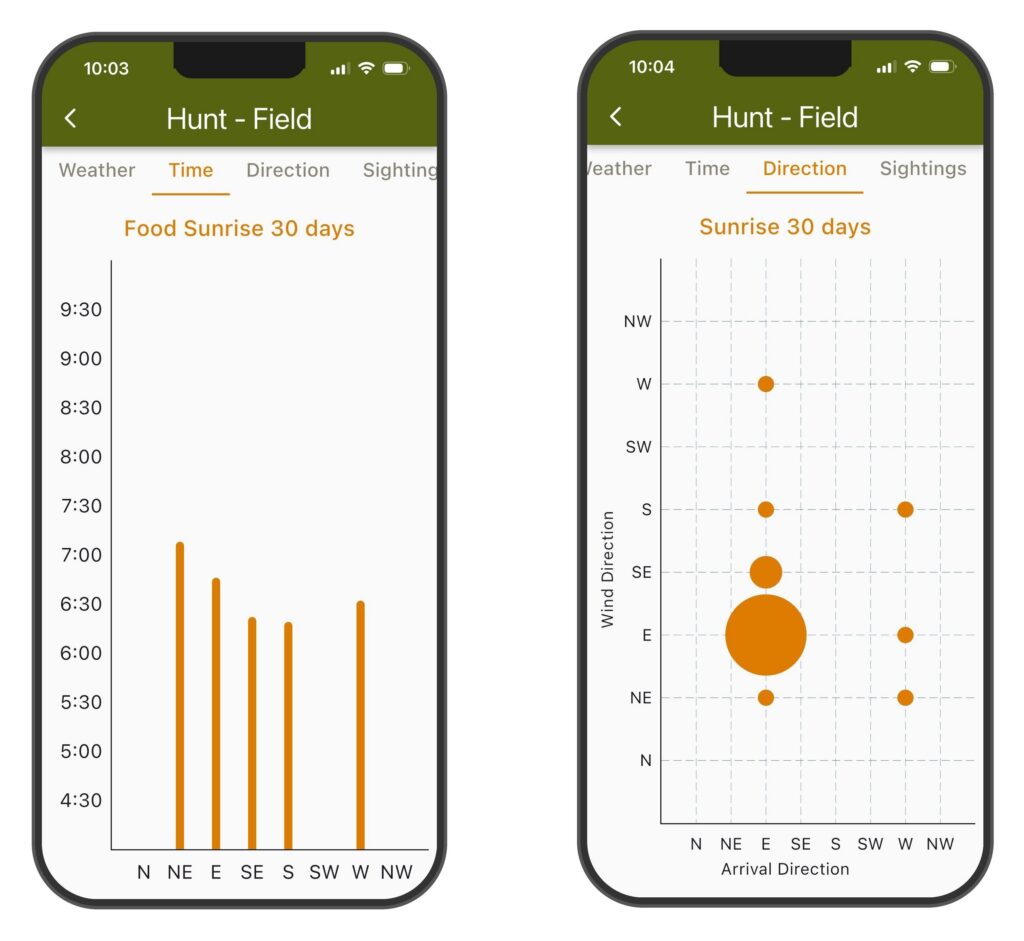
Deer per day by wind provide great insight to zero in on patterns by tag.
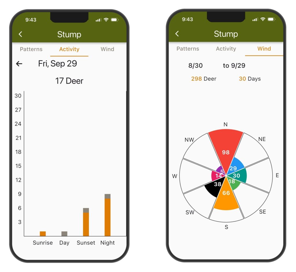
See bucks and does by period for each day.
This chart not only reveals wind activity ratios of prevailing wind factors.
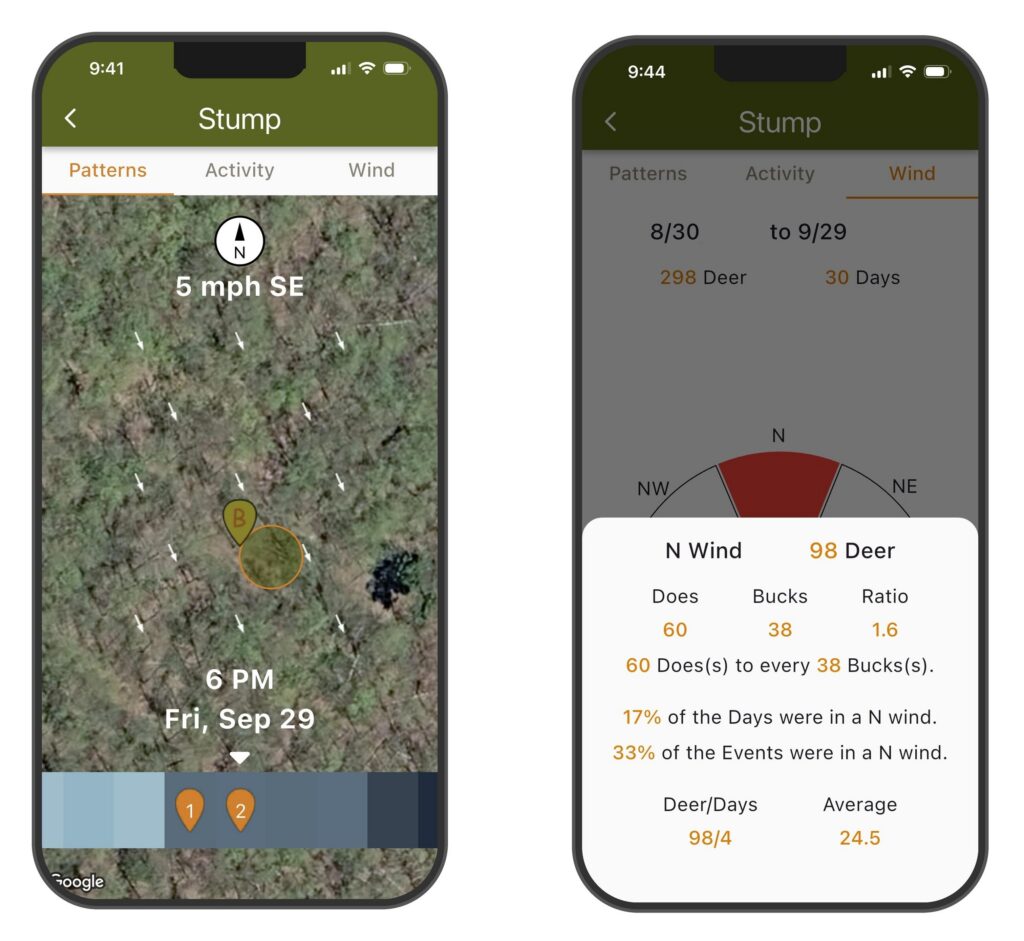
For each stand see deer movement by wind and select specific hours for the analysis. Zero in on the patterns.
See more detail by hour on wind, buck or doe, and number of deer at each location. This provides even more insight into patterens.
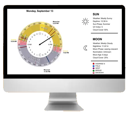
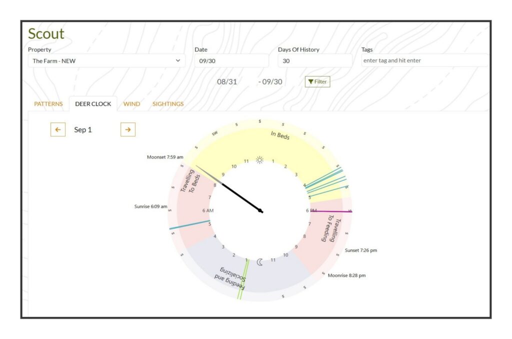
Only with DeerMapper can you see the human clock vs the deer clock. Quick visual of the deer activity by day. So good!
Only DeerMapper shows wind ratios including prevailing winds. Prevailing winds effect frequencies of their favorite wind.
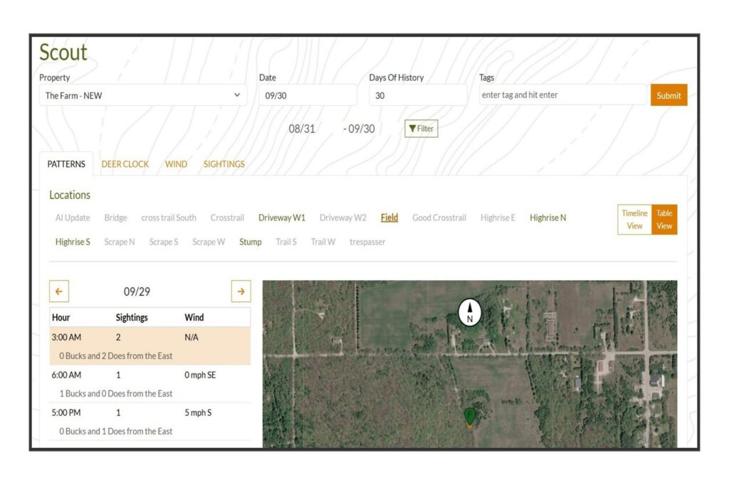
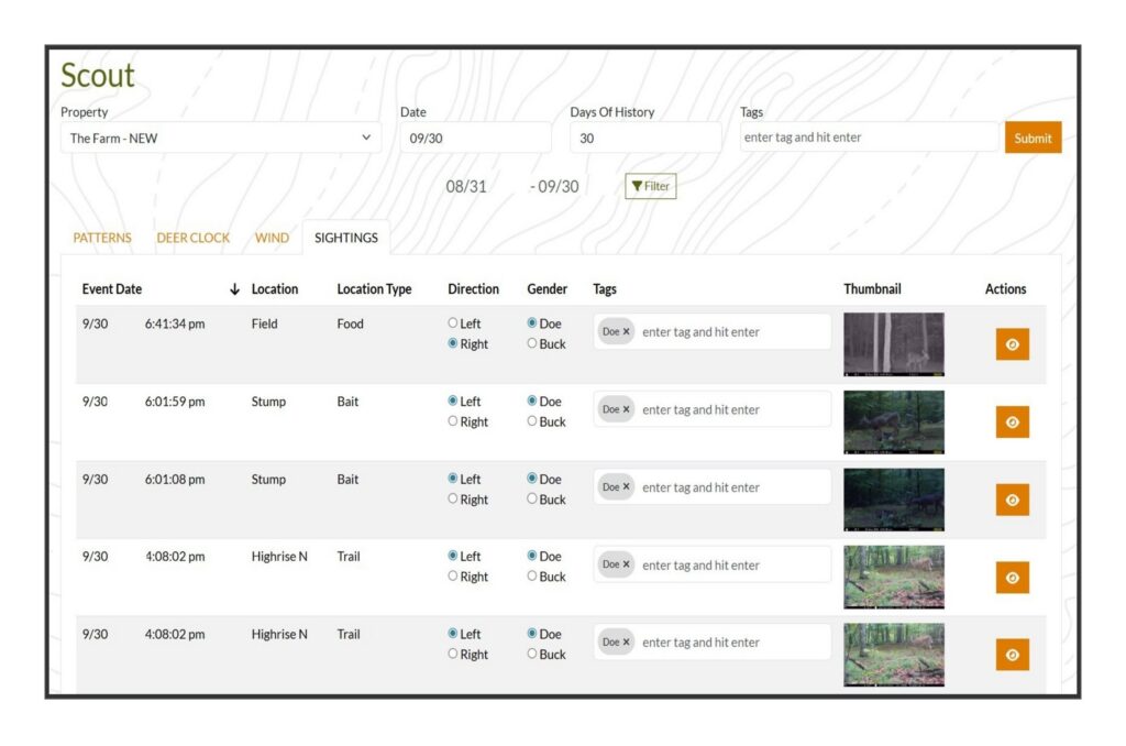
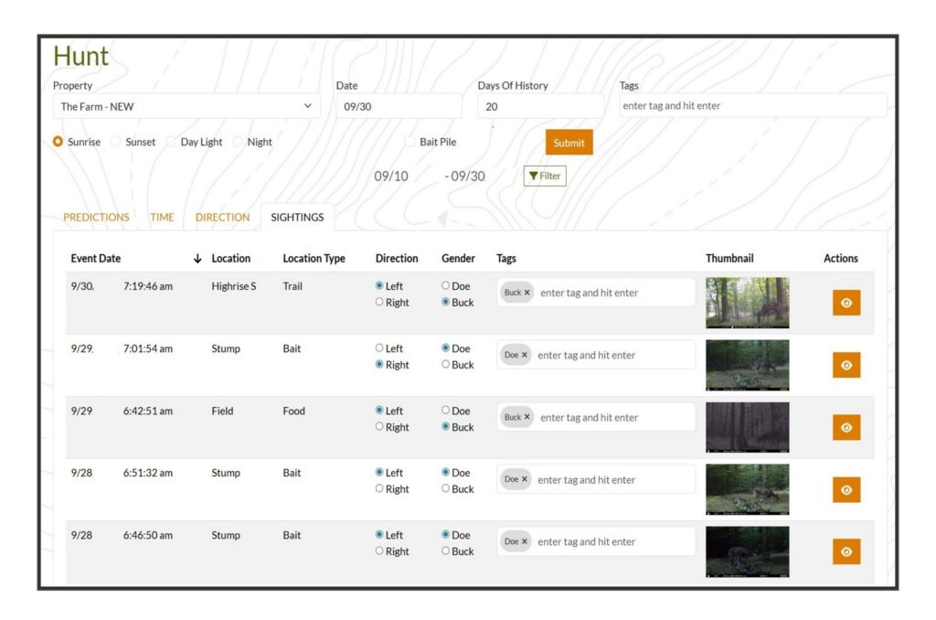
This is a listing of sightings by the filters with detail. Here is where you can manually edit more info into each movement.
link to Map
Tailor every prediction to target specific deer for your hunt.
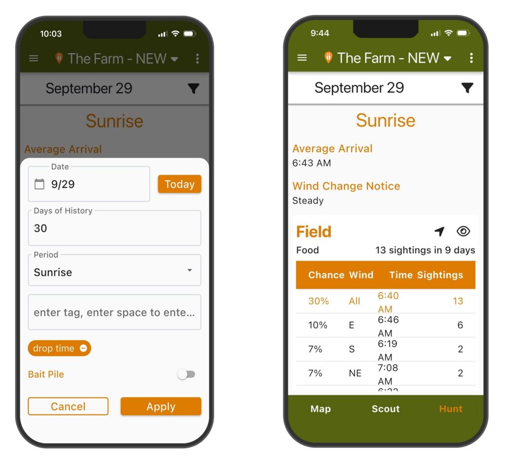
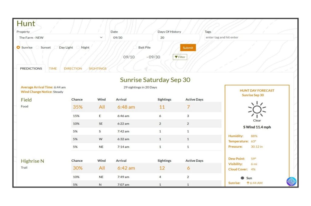
Know the time to meet the deer and the arrival direction by wind for each stand.
Full prediction dashboard showing every stand ranked by chance, with arrival time, wind, sightings, and the live Hunt Day Forecast.
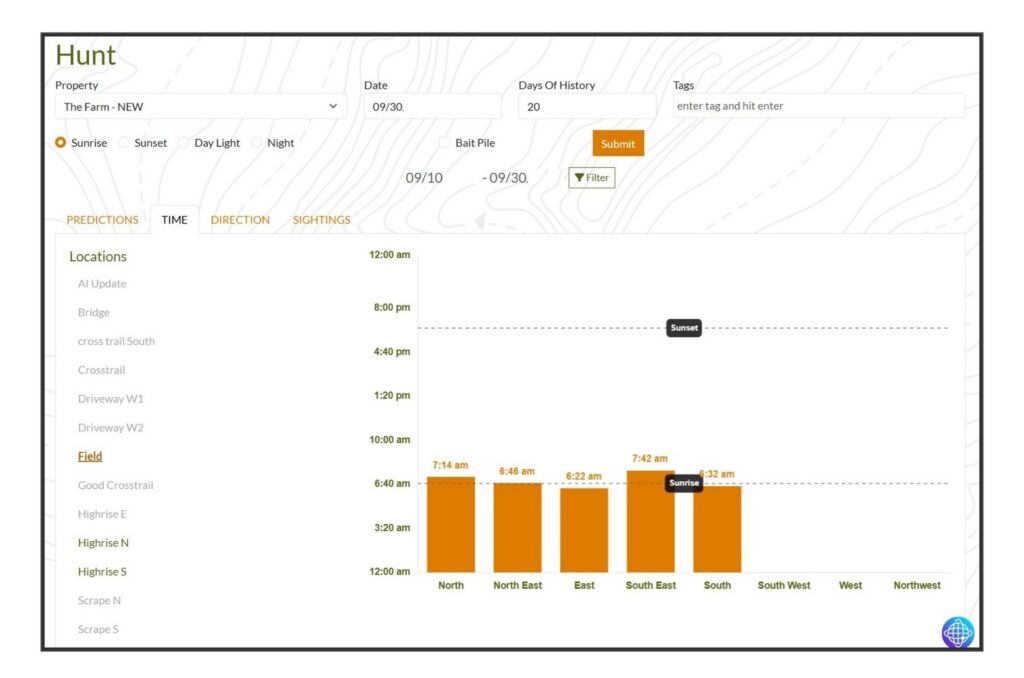
Know exactly when deer arrive at your stand for every wind.
This chart not only reveals wind activity ratios of prevailing wind factors.
For each stand see deer movement by wind and select specific hours for the analysis. Zero in on the patterns.
Every sighting with location, location type, arrival direction, gender, tags, and a thumbnail — Edit your complete deer record.
link to Map
You Ask The Questions
About Your Property
Ask any question about deer movement.
AI-powered answers, trained on your property’s data.
About Public Land
Ask any question about deer movement by location type: Water, Bait, Hub, Rub, Scrape, Trail, …
AI-powered answers, trained on thousands of properties.
AI will do the Research
Sample questions.
AI Keeps getting smarter
Your photos, your questions and your discussion all are used to train DeerMapper AI.
There is no limit to what DeerMapper will discover!
Lets try the question
“How does humidity and wind direction effect deer movements?”